-
- 45 – 65 mm rain forecast through Monday overnight
- Strong winds and storm surge
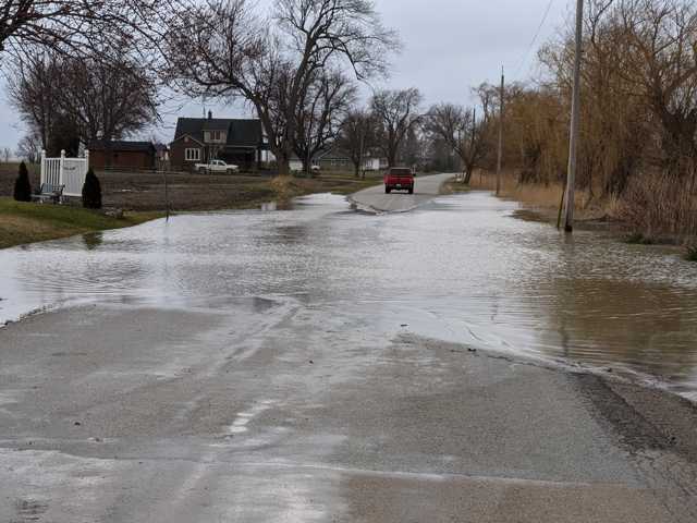
- Minor flooding possible
Rainfall events over the past month have left soils saturated and water levels elevated across the watershed, making the watershed more susceptible to runoff and water levels responding more quickly to precipitation. Flooding into natural floodplain areas, parks and farmland is possible.
Strong winds are anticipated with this system, beginning southwest and becoming northeast this evening and into Monday. Forecast models predict waves up to a metre in height on Lake Huron near Sarnia, and half to one metre near Mitchell’s Bay, Lake St. Clair. Residents along these shorelines should anticipate storm surge as the winds will impact water levels on the lakes.
Individuals are reminded to avoid shorelines, watercourses and flooded areas due to dangerous conditions, slippery banks and cold, swift moving water. Children and pets should be kept away from the water.
The Conservation Authority continues to monitor watershed conditions and will issue advisories to municipalities and media should flood issues arise.
Municipal emergency response staff and road superintendents should monitor local conditions closely.
This message will remain in effect until Tuesday, October 26, 2021, unless otherwise updated.


