Highlights:
- 15 – 25 mm of precipitation forecasted over the next 48 hours
- Water levels expected to rise
- Fast flowing water and slippery stream banks
- Potential road closures
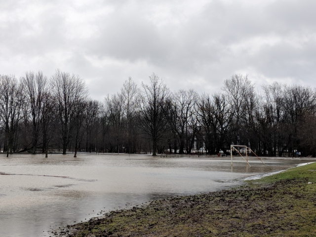
The precipitation forecast for today and tomorrow calls for total accumulations between 15 mm and 25 mm. Potential for thunderstorms this evening could produce increased localized rainfall and flooding. Snowpack in the region has substantially degraded in the past two weeks and further impacts from snow on watercourses is anticipated to be minimal. Water levels are expected to rise with the potential for localized flooding in floodplain areas, parks and farm fields throughout the region. Water levels are anticipated to remain high through the weekend as the water makes its way through the rivers.
Fluctuations in temperatures above and below the freezing mark is expected to make conditions precarious. River banks are expected to be slippery, with possible minor erosion. Residents are reminded to avoid watercourses and flooded areas due to slippery banks and cold, swift moving water. Children and pets should be kept away from the water.
The Conservation Authority continues to monitor watershed conditions and will issue advisories to municipalities and media should flood issues arise.
Municipal emergency response staff and road superintendents should monitor local conditions closely.
This message will remain in effect until Sunday, March 17, 2019 unless otherwise updated.


