Highlights:
- 10 – 15 mm of precipitation forecast over the next 72 hours
- Heavy rain anticipated later in the week
- Water levels expected to rise
- Fast flowing water and slippery stream banks
- Potential road closures
Upwards of 15mm of precipitation was received in areas across the watershed this past weekend. Approximately 5 mm of rain is anticipated today, followed by a low pressure system expected to bring another 5 mm of rain across the region on both Tuesday and Wednesday. Long-range forecasts are predicting upwards of 35 mm of rain Friday and into Saturday.
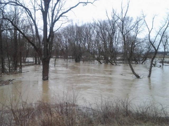
Rain throughout the week may result in soils becoming saturated and could lead to increased flooding in certain areas across the region.
Water levels are expected to rise with the potential for localized flooding in floodplain areas, parks and farm fields throughout the region. Water levels are anticipated to remain elevated throughout the week as the water makes its way through the rivers.
River banks are expected to be slippery, with possible minor erosion. Residents are reminded to avoid watercourses and flooded areas due to slippery banks and cold, swift moving water. Children and pets should be kept away from the water.
The Conservation Authority continues to monitor watershed conditions and will issue advisories to municipalities and media should flood issues arise.
Municipal emergency response staff and road superintendents should monitor local conditions closely.
This message will remain in effect until Wednesday, April 17, 2019 unless otherwise updated.


