Highlights:
- Severe Thunderstorm watch for the entire watershed
- Precipitation amounts of 10 – 15 mm forecast
- Water levels elevated
- Fast flowing water and slippery stream banks
- Potential road closures
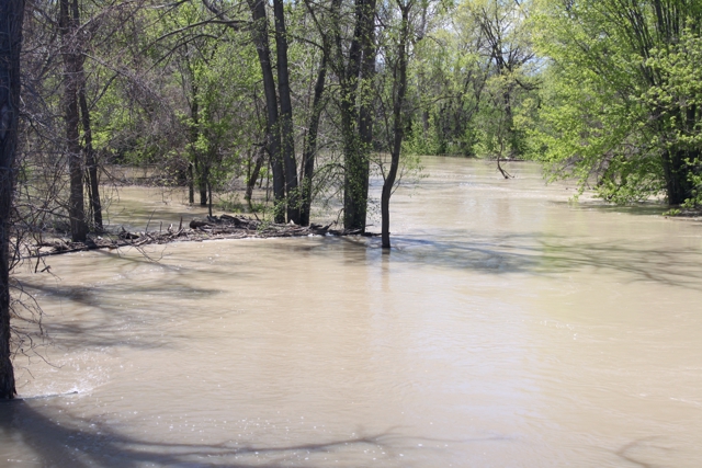
A wet spring, coupled with elevated water levels in the St. Clair River and Lake St. Clair, has resulted in the Sydenham River remaining high throughout the watershed, particularly in Wallaceburg. The current forecast is calling for 10 – 15 mm of precipitation over tonight and early tomorrow morning, which may further elevate water levels into natural floodplain areas, agricultural fields and parks.
High intensity rainfall is possible, especially during thunderstorms. High amounts of rainfall in a short period of time can lead to increased runoff and flash flooding, particularly in urban areas.
Saturated soil conditions from the rain and prolonged high water levels could contribute to ponding, increased runoff into watercourses, and possible increased erosion and seepage issues.
River banks are expected to be slippery, with possible erosion. Residents are reminded to avoid watercourses and flooded areas due to slippery banks and cold, swift moving water. Children and pets should be kept away from the water.
The Conservation Authority continues to monitor watershed conditions and will issue advisories to municipalities and media should flood issues arise. Municipal emergency response staff and road superintendents should monitor local conditions closely.
This message will remain in effect until Monday, June 3, 2019 unless otherwise updated.


