Flood Watch Notice
-
- Precipitation ranges of 50-150mm since July 9, 2024
-
- Road closures
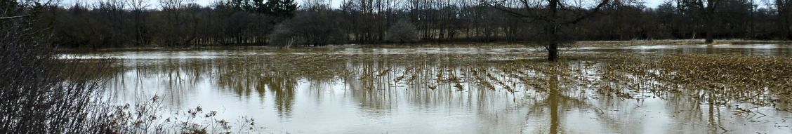
- Elevated water levels, potential for flooding
- Saturated soils, ponding and flooding in floodplain areas
Message: Elevated water levels
|
Widespread rain across the region has led to the ground across the St. Clair watershed to be completely saturated as a result, water levels are elevated across the region. Roads will be impacted due to the increase in runoff and elevated water levels. Highway 402 is closed due to flooding between Kerwood Road and Nauvoo Road. The upper reaches of the watershed should be expected to experience elevated water levels for the next 24 hours. Widespread flooding is happening across several areas in the St. Clair Region watershed. Localized flooding in low-lying areas; floodplain, agricultural, and parkland is anticipated. Individuals are reminded to avoid watercourses and flooded areas due to dangerous conditions, slippery banks, and cold, swift-moving water. Children and pets should be kept away from the water. The Conservation Authority continues to monitor watershed conditions and will issue advisories to municipalities and media should flood issues arise. Municipal emergency response staff and road superintendents should monitor local conditions closely. This message will remain in effect until Thursday, July 18, 2024, at 12pm unless otherwise updated. |