Highlights:
- McKeough Dam in operation
- Water levels still rising
- Strong winds and wave action
- Road Closures
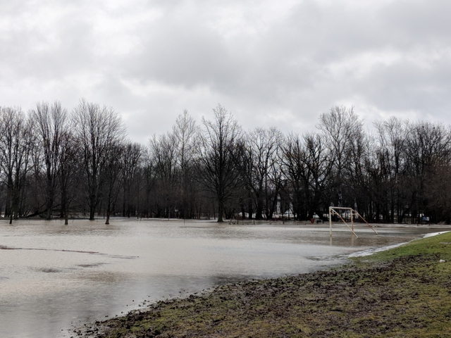
Significant rainfall and strong winds have resulted in flooding across the watershed. The McKeough Dam remains in operation and water continues to be diverted to the St. Clair River. Water levels are elevated into floodplain areas, parks and farm fields, and roads are impacted. Water levels in Wallaceburg are slowly receding, however several locations across the watershed are still seeing rising levels as the rainfall moves through the river system.
Soils are expected to be saturated from the rain and could contribute to ponding, increased runoff into watercourses, and possible increased erosion and seepage issues. Wind speeds have reduced but remain from a westerly direction, continuing to cause a backwater effect in the Wallaceburg area and slowing the flow of water out of the Sydenham River. Strong wind warnings remain in effect for Lake St. Clair and Lake Huron.
The following roads will be impacted by high water levels:
St. Clair Township:
- Stanley Line east of Kimball Road
- Pretty Road north of McCallum Line
Enniskillen Township:
- Durham Creek Line at Black Ash Line
- Fairweather Road Between Rokeby Line and Shiloh Line
- Fairweather Road between Oil Springs Line and Aberfeldy Line
River banks are expected to be slippery, with possible minor erosion. Residents are reminded to avoid watercourses and flooded areas due to slippery banks and cold, swift moving water. Children and pets should be kept away from the water.
The Conservation Authority continues to monitor watershed conditions and will issue advisories to municipalities and media should flood issues arise.
Municipal emergency response staff and road superintendents should monitor local conditions closely.
This message will remain in effect until Sunday, November 3, 2019 unless otherwise updated.


