Highlights:
- Minor flooding in Wallaceburg expected
- Road Closures
- Fast flowing water and slippery stream banks
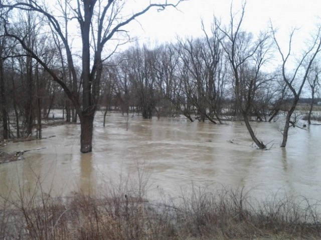
Upwards of 75mm of rain have been received in some areas across the watershed. Water levels continue to rise and minor flooding is expected in Wallaceburg. The McKeough Dam is currently on standby.
Winds from a westerly direction are anticipated later this morning and have the potential to create a backwater effect, further elevating water levels in Wallaceburg. Wind gusts up to 50 km/h are expected Sunday morning.
The following roads will be impacted by flooding:
St. Clair Township:
- Stanley Line east of Kimball Road
- Pretty Road north of McCallum Line
Enniskillen Township:
- Durham Creek Line at Black Ash Line
- Fairweather Road Between Rokeby Line and Shiloh Line
- Fairweather Road between Oil Springs Line and Aberfeldy Line
River banks are expected to be slippery, with possible minor erosion. Residents are reminded to avoid watercourses and flooded areas due to slippery banks and cold, swift moving water. Children and pets should be kept away from the water.
The Conservation Authority continues to monitor watershed conditions and will issue advisories to municipalities and media should flood issues arise.
Municipal emergency response staff and road superintendents should monitor local conditions closely.
This message will remain in effect until Monday, January 13, 2020, unless otherwise updated.


