Highlights:
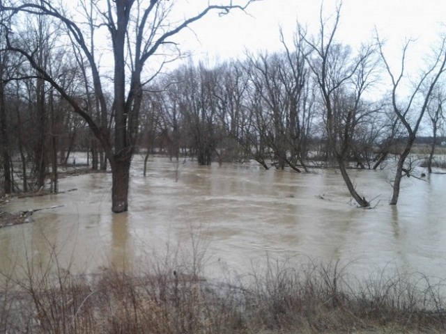
River flows are anticipated to be elevated with possible localized flooding in floodplain areas as a result of recent rainfall and snow melt. Rainfall and warmer temperatures have left minor traces of snow on the land and further influence of snow on the Sydenham River water levels is not expected.
The following roads will be impacted by high water levels. These roads include:
Water levels across the watershed are moderating, however, warmer temperatures and further rainfall forecast for Wednesday and Thursday is anticipated to result in water levels rising again.
Fluctuations in temperature and recent rainfall over the past two weeks has resulted in the deterioration of ice on the river. Minor ice jamming and localized flooding is possible in the lower reaches of the watershed between Wallaceburg and Dresden as ice begins to shift.
St. Clair River
Recent rainfall and warm temperatures have resulted in ice deterioration along the St. Clair River. Localized ice jamming may be possible and could result in minor flooding in low-lying areas.
The Conservation Authority continues to monitor watershed conditions and will issue advisories to municipalities and media should flood issues arise. Residents are reminded to avoid watercourses and flooded areas due to slippery banks, cold and swift moving water and deteriorating ice. Children and pets should be kept away from floodplain areas.
Municipal emergency response staff and road superintendents should monitor local conditions closely.
This message will remain in effect until Friday, February 08, 2019 unless otherwise updated.


