- Risk of thunderstorms, 15-40 mm rain received
- Strong winds and waves
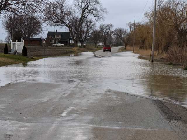
- Possible storm surge and minor flooding
- Possible road closures
Winds are anticipated to be westerly this afternoon, gusting upwards of 50 km/h over Lake St. Clair mid-day and continuing through the evening and overnight, subsiding Wednesday morning. Strong westerly winds in this region are causing a backwater effect in the Wallaceburg area and elevating water levels. Residents along the shoreline may experience wind-driven flooding and wave action, with a potential for erosion.
Westerly winds gusting upwards of 50 km/h are also anticipated on Lake Huron, with waves building throughout the day reaching two metres overnight before subsiding Wednesday afternoon. The Lake Huron shoreline can anticipate sustained wind action and possible erosion, particularly the Old Lakeshore Road area of Brights Grove.
- Nelson Street between Wall Street and Trafalgar Street
- Otter Line
- Emily Street at Elizabeth Street
- Main Street in Mitchell’s Bay east of Hinkle Point Road, as well as several side streets in the village
- Waterworks Road north of Courtright Line
The Conservation Authority continues to monitor watershed conditions and will issue advisories to municipalities and media should flood issues arise.
Municipal emergency response staff and road superintendents should monitor local conditions closely.
This message will remain in effect until Thursday, June 25, 2020, unless otherwise updated.


