Highlights:
- Upwards of 30 mm of rain received in locations across the region as of this afternoon, with an additional 5 – 10mm still expected
- 20 – 30 mm of rain received yesterday
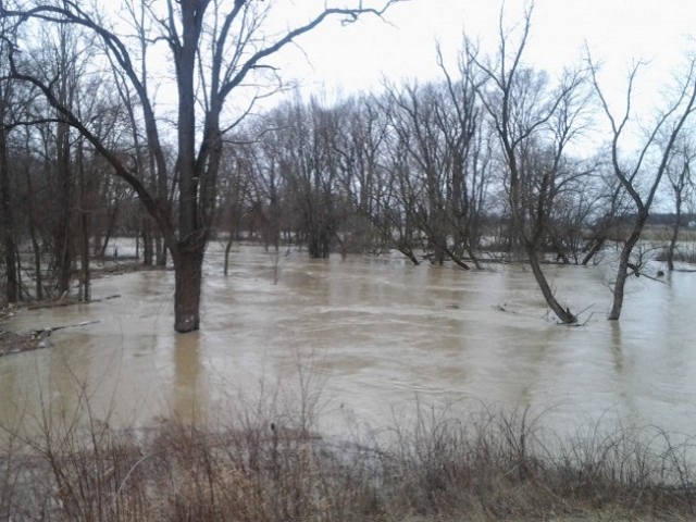
- Water levels elevated and rising
- Fast flowing water and slippery stream banks
- Road closures
Road Closures:
- Waterworks Road between Courtright Line and Moore Line
- Potential for additional road closures
Heavy precipitation over the past few days has resulted in water flowing into natural floodplain areas, agricultural fields and parks. With additional precipitation forecasted, water levels are expected to continue to rise and additional road closers are possible. Soils have become saturated in various areas throughout the watershed, which may contribute to ponding and increased runoff into rivers.
River banks are expected to be slippery, with possible minor erosion. Residents are reminded to avoid watercourses and flooded areas due to slippery banks and cold, swift moving water. Children and pets should be kept away from the water.
The Conservation Authority continues to monitor watershed conditions and will issue advisories to municipalities and media should flood issues arise. Municipal emergency response staff and road superintendents should monitor local conditions closely.
This message will remain in effect until Tuesday, April 23, 2019 unless otherwise updated.


