Highlights:
- Localized flooding along some of the smaller watercourses in the region
- Slippery stream banks
- Road closures
Current:
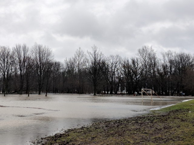
Over the last week, the SCRCA watershed has received more than 80 mm of rain and this has caused water levels to rise and be near or over the top of bank. Localized flooding is occurring at low lying areas, mostly in floodplain, agricultural and parkland areas.
Several roads continue to remain impacted this week. These roads include:
Waterworks road between Courtright Line and Moore Line
Stanley Line between Kimball Road and Waubuno Road
Short Term:
Precipitation forecast for today calls for an additional 10 mm across most parts of the watershed. Water levels will continue to remain high and near top of the bank conditions in most areas of Sydenham River for the next few days. Drains and smaller watercourses in upstream areas will experience localized flooding in some areas.
Municipal emergency response staff and road superintendents should monitor local conditions closely.
Residents are reminded to avoid watercourses and flooded areas due to saturated and slippery banks as well as the danger of swift moving water.
The St. Clair Region Conservation Authority will monitor the flood condition of the watersheds in the region and will provide warnings to municipal officials and media in the event conditions develop which could result in the potential of more severe flooding.
This message will remain in effect until Wednesday, November 7, 2018 unless otherwise updated.


