Water Safety/Flood Outlook
-
- Temperatures are expected to be above freezing
- Rainfall amounts of 5 to 15 mm of rain
- Saturated soils; increased runoff and ponding possible
Temperatures are expected to be above freezing in the coming days. The temperature will start to warm overnight on Tuesday and stay above the freezing mark for the rest of the week into the weekend. Rain is expected on Wednesday, Thursday, and Friday. The estimated snow water equivalent at this time is 15-30 mm. The snowpack will initially absorb much of the forecasted rain but will become saturated with the additional rainfall resulting in runoff across the watershed.
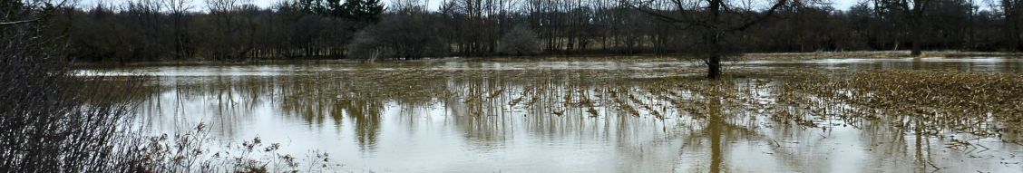
Runoff into watercourses will lead to a slow rise in water levels, which has the potential to elevate levels into natural floodplain areas, parks, and farm fields. Soils are expected to be saturated from the rain and could contribute to ponding, increased runoff into watercourses, and possible increased erosion and seepage issues.
Individuals are reminded to avoid watercourses and flooded areas due to dangerous conditions, slippery banks, and cold, swift-moving water. Children and pets should be kept away from the water.
The Conservation Authority continues to monitor watershed conditions and will issue advisories to municipalities and media should flood issues arise. Municipal emergency response staff and road superintendents should monitor local conditions closely.
This message will remain in effect until Monday, January 29, 2024, unless otherwise updated.


