-
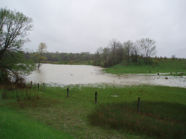
- Water levels beginning to fall
- Several roads remain impacted by flooding
- Severe thunderstorm watch, 5-10 mm of rain next 24 hours, potential for higher amounts
Water levels across the watershed remain high and into natural floodplain areas after receiving between 70 mm and 95 mm of rain over the past five days. Conditions are stabilizing and levels are falling at all stream gauge monitoring stations in the watershed.
Isolated thunderstorms are developing over southern Ontario this morning with additional thunderstorms developing over Michigan which are expected to track eastward into Ontario sometime late this morning or afternoon. As the Great Lakes are very cold, there is a great deal of uncertainty of how strong these thunderstorms will become as they track eastward. Forecasts are currently predicting 5-10 mm of rain over the next 24 hours, however precipitation amounts may vary by location and higher amounts are possible should the thunderstorms intensify.
Winds are anticipated to be from the south, becoming southwesterly before turning west. Gusts are predicted to be near 60 km/h, however may be higher with higher intensity thunderstorms. To the south of the watershed, a tornado watch has been issued for Chatham. Areas in the southern portion of the watershed may experience higher winds with storms tracking along the south. Winds from a south or westerly direction have the potential to cause a backwater effect in the Wallaceburg area, which can slow the flow of water out of the Sydenham River and contribute to the elevated water levels.
-
- Stanley Line between Kimball and Waubuno Road
- Waubuno Road between Bickford Line and Oil Springs Line
- Pretty Road north of McCallum Line
- Waterworks Road north of Courtright Line
- Telfer Road between Courtright Line and Moore Line
- Plowing Match Road between Petrolia Line and Rokeby Line
- Emily Street at Elizabeth in Wallaceburg
- Booth Road between McCrary Line and Langstaff Line
The Conservation Authority continues to monitor watershed conditions and will issue advisories to municipalities and media should flood issues arise.
Municipal emergency response staff and road superintendents should monitor local conditions closely.
This message will remain in effect until Saturday, April 8, 2023 at 12pm unless otherwise updated.


