-
- Continued loss of ice and snow
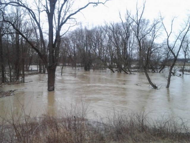
- Minor flooding, potential for minor ice jamming
- Gale Wind Warning for Southern Lake Huron
- Increased wave action, possible erosion
Temperature and precipitation forecasts for the coming days indicate the continued slow melt of snow. Water levels are anticipated to remain high with minor flooding, and minor ice jamming is possible in areas where ice continues to disintegrate and move through the system.
The following roads may be impacted by high water levels:
– Stanley Line between Kimball Road and Waubuno Road
– Pretty Road north of McCallum Line
– Waterworks Road north of Courtright Line
A gale warning is in effect today through Friday for Southern Lake Huron. Winds are expected to be north/northwesterly today through the weekend, with gusts between 40-50 km/h today becoming 50-60 km/h late Friday into early Saturday, subsiding Saturday afternoon. Waves are anticipated to be 1-2 m today and 3-4 m Friday morning. Residents along the Southern Lake Huron shoreline may experience increased wave action and possible erosion as a result.
Residents are reminded to avoid shorelines, watercourses and flooded areas due to dangerous conditions, slippery banks and cold, swift moving water. Children and pets should be kept away from the water.
The Conservation Authority continues to monitor watershed conditions and will issue advisories to municipalities and media should flood issues arise.
Municipal emergency response staff and road superintendents should monitor local conditions closely.
This message will remain in effect until Monday, March 8, 2021, unless otherwise updated.


